Gamaksan Mountain
Gamaksan Mountain
Gamaksan Mountain is located at the boundary of Choongcheongbook-do Jecheon-city Bongyang-eup and Gangwondo Wonju-city Sinrim-myeon. Gamaksan Mountain hiking course is from Jecheon Baengnyeonsa Temple ~ Gamaksan Mountain and from Whangdun-li Changgol bus stop ~ Gamaksan Mountain with Wonju-city sinrim-myeon. Whangdun-li → Baengnyeonsa Temple → Gamaksan Mountain takes about 2 hours. Gamaksan Mountain is 945m, but distance from starting point to top of the mountain is not far so one-day trip is possible. From Jecheon station, if you select the 5th road and turn into left road of 'Dongil ready-mixed concrete', and then cross the 'Angyeong bridge', you can see the 'Myeongam reservoir'. Around the reservoir, there are fishing spots and charcoal kiln. You can go to Myeongam-li through the ways around the reservoir. Starting point is 'Bikkijae town' and this town has monuments. From this place to 'Baengnyeonsa Temple' paves were build and slope increases as you pass the 'prayer house'. 'Baengnyeonsa Temple' means white lotuses which blossoms in the pond at the front of Buddhist temple. In this place a parking lot was build. If you see 'Seated statue of wooden Amitabha Buddha' and its temple, look up behind the temple and you can see the two rocks. These are called 'young boy rock'(Gamak rock) and Taoist fairy rock'. The ‘young boy rock' is called 'Weolchulbong' and the 'Taoist fairy rock' is called 'Illchulbong.' 'Myeonam-li' which is the name of the town is based on 'Weol' and 'Ill'. You can obtain drinking water only in this place so you must take some water when going to this place. Baengnyeonsa Temple section (Baengnyeonsa Temple ~ Top of this mountain ~Hawthorn ~ Mun rock) whole time of hiking: 2 hours 20 minutes. Time for hiking per section: Baengnyeonsa Temple - (17 minutes) - In front of 'Young boy rock' (Weolchul rock) - (8 minutes) - 'Taoist fairy rock' (Illchul rock) - (13 minutes) - 119 direction board (Gamaksan Mountain 04) - (26 minutes) - Hawthorn - (16 minutes) - 119 direction board (Gamaksan Mountain 03) - (3 minutes) - Heliport - (16 minutes) - Crossroad - (30 minutes) - Mun rock - (10 minutes) - Myeongam bridge
The trail starts 10m under the Baengnyeonsa Temple through the access road. You can walk through the right of mountain path and you can find signposts like 'Gamaksan Mountain 1.0km' and 'Myeongam prayer house 3.0km'. When you walk, it can be hard because this way is a single path and shows high altitude. Anyway, this way is known as 'Gameomsansung'. Baengnyeonsa Temple is 800m therefore it is not too hard since you can barely find steep slope. This way is gentle and regular and it is not hard to walk.
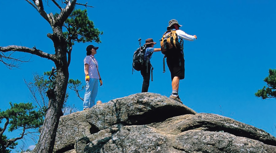
From starting point, if you walk about 10 minutes, you can find downhill and then you can find turn-off. If you go up through the left, you can find the signpost which contains 'Jaesadong(Baengnyeonsa Temple), Valley course (Baengnyeonsa Temple) ridge' and 'Top of the mountain'. You can wonder why you can see the 'Top of the mountain', but this sign means the way to go up to the big rock called the 'Young boy rock(Weolchul rock)'. If you go straight through the right of this signpost, you can find ropes which can help you to climb to the top of the rock, but you should be very careful because this rock has vertical wall.
If you come back to the signpost and go down the right side of this site, you can see 'Taoist fairy rock' which is called 'Illchul rock'. If you go down through the big rock, you can find the 'monument of Gamak's top'. In 2001.09 it was moved to this place by helicopter of The Forest Service. You must press this monument and then you can go to another place. If you want to go up to 'Taoist fairy rock', you should cross the wooden bridge but this bridge looks weak. And the way for going up through the rock has no ropes. You should go up to 'Taoist fairy rock' by grasping the pine tree and you should be careful. After you reach the 'Taoist fairy rock', you can see the 'Young boy rock' and 'Baengnyeonsa Temple'.
If you go down the rock, you can find the signpost which contains ‘Myeongam prayer house 3.5km, Seokgi rock 2.9km' with large empty space. This empty space is so large that you can eat lunch or rest in this place. You can go down the ridge which is from empty space to Seokgi rock (905.7m) and then you can find 119 direction board (Gamaksan Mountain 05), where you will see the turn-off. If you go right of this place, you can find 'Baengnyeonsa Temple'. If you can find the signpost and go through the mountain way for 10 minutes, you can find a single path to the cliff. If you go straight to the left, you can find the way with ropes and then if you go straight for 5 minutes, you can find 119 direction board (Gamaksan Mountain 04). As a course of Gamakbong ~ Yongdu Mountain, there is a signpost which contains ‘Baengnyeonsa Temple 1.0 km, Seokgi rock 2.6 km'. You can frequently find direction posts which is different from other mountains of Jecheon.
Soon, you can find downhill and then you can find the cliff which can show the view to the left side. Ropes are installed at the steep slope and this place is not dangerous. If you go straight for 10 minutes, you can see 'Asia Cement Company' which is located to the far left of this place. 'Daraesan Mountain' which exposes bare skin of itself looks horrid. If you go straight for 3 minutes, you can find the way which has ropes and wooden ladder.
You may go up and down for 15 minutes and you may reach the front of hawthorn. This is an empty space and you can sit down and rest. In this place, you can find post signs which contains ‘Seokgi rock 1.6km, Gamaksan Mountain 1.0km' ‘Whangdun 2.5km, Yongdu Mountain 5.6km, Seokgi rock 2.0km, Gamaksan Mountain and Yobugol 1.7km.’
After passing the planted area of the Japanese larch, go straight for 12 minutes and then you can find 119 direction board (Gamaksan Mountain 03). You can go down from this site. You can find wild mushrooms regularly in this section. After 3 minutes, you can find the heliport. You can find the post sign which contains ‘Gamaksan Mountain 1.6km, Seokgi rock 1.0km, valley with chestnut tree 2.8 km.’ By the way, 'Valley with chestnut tree 2.8 km' was misspelled, because chestnut tree is located at 'Tongdosa' and this should be corrected with 'Hunter gol'. But in the map which was released by the Territory Information Association, chestnut tree was written in this map and Mun rock was written to the east of this map.
Steep downhill which can lead travelers to the Mun rock is overgrown and travelers barely find this downhill. After 9 minutes, you can find the path easier and if you go to the right side, after 3 minutes, you can find the valley. Then if you go straight for 4 minutes, you can find the turn-off. The right side of this place is the way to the 'Mun rock'. After 5 minutes, you can find the second valley and if you pass the valley and go straight for 15 minutes, you can find a large road with rock.
If you cross the valley, you can see the laying uprooted tree. After 6 minutes, you can cross to the other valley where pure and clean water awaits compared to other places. Downhill is even and regular. If you go down for 2 minutes, you can find a large rock which is good for rest. You may notice that this rock is 'Mun rock'. This 'Mun rock' is based on a shape of door(Mun). Under the rock, sometimes prayers visit this place. From large site, if you see the Mun rock, you can find one gentle waterfall. Through unpaved road, if you go straight for 3 minutes, you can reach the 'Myeongam Bridge'.